Weirton Council to consider new GIS

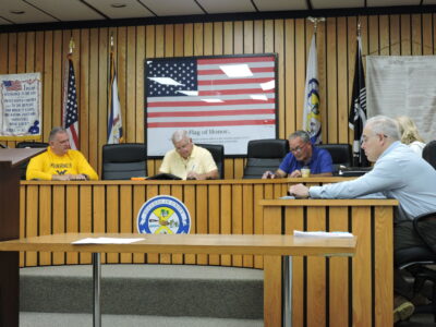
PROPOSAL — Matthew Bainbridge, senior project manager at Civil and Environmental Contsultants Inc., discusses a proposal for a new Geographic Information System for use by the City of Weirton during Thursday’s meeting of the city’s Finance Committee. A contract for the proposed system will be voted on by city council Monday. -- Craig Howell
WEIRTON — Weirton Council will be presented with a resolution, Monday, for a contract for the creation and implementation of a Geographic Information System for the city, although not everyone is on board with the proposal.
The contract, which would involve services from Civil and Environmental Consultants Inc., would involve a cost of $50,000 from the city’s general fund, with $25,000 coming from the Weirton Area Water Board and $25,000 from the Weirton Sanitary Board to cover the initial setup and implementation of the system.
“This is a pivotal opportunity to invest in GIS,” explained Utilities Director Butch Mastrantoni during Thursday’s meeting of the city Finance Committee. “It’s vital we get this put in place.”
According to Matthew Bainbridge, senior project manager at CEC, use of such a GIS system would allow the city to keep track of water and sewer line locations in Weirton, but also provide elements for city planning and development, reports for the Inspections Department, track garbage collection and the completion of snowplow routes, grass mowing and even help residents keep track of their polling locations for elections.
“It would be as real time updated as the technicians in the field are updating it,” he said.
A database for the system would be established through the use of a mobile LiDAR – Light Detection and Ranging – unit, Bainbridge explained, noting it would provide accuracy within one foot for its measurements.
Mastrantoni, as well as Planning and Development Director Mark Miller pointed to the potential economic development in Weirton as a major selling point for the GIS.
“There are a lot of projects we’re looking to roll out,” Miller said, pointing, in particular, to an ongoing housing study and plans to better track sidewalk maintenance needs including the installation of ADA-complaint ramps. “With Form coming, we have a lot of people asking about housing.”
Miller also pointed out essentially every city department head was on board with the proposal, which previously was budgeted by council.
Not everyone was fully on board with the proposal, though.
Ward 3 Councilman Fred Marsh said he understands the need for a GIS to assist with the city’s utility work and development.
“I have a hard time with the mowing and snow plows and garbage collection,” Marsh said.
Ward 7 Councilman Terry Weigel also raised the issue of responsibility for maintaining the system once it goes online. Officials previously noted the city had a GIS, in coordination with local counties, but it was not kept up-to-date.
Mastrantoni said the options could include an ongoing contract with CEC or the city creating a staff position.
City Manager Mike Adams said it was possible a staff position could be shared between the general fund and the utility boards, or responsibilities given to existing staff.
“They’re not going to dedicate 40 hours a week to it,” Adams said.
Ward 6 Councilman Enzo Fracasso was the lone committee member who spoke in support.
“This is another tool in moving the city forward,” Fracasso said.
While not receiving a recommendation from the Finance Committee, the contract proposal will go before the full city council for its consideration Monday.
Local News

Steubenville native first in clinical trial using mixed reality in the operating room

Steubenville Grecian Food Festival a chance to celebrate

Wintersville officials hear mapping presentation

From unfilled gas tanks to fewer frills, retailers see US consumers rethink their spending

Future leaders